Google Maps Elevation: A Comprehensive Overview
Google Maps has become an indispensable tool for navigating the world around us. From providing detailed directions to offering street views and satellite imagery, it has transformed the way we travel. One of its lesser-known but equally significant features is its elevation data. Understanding elevation through Google Maps can be particularly beneficial for various activities, including hiking, urban planning, and even environmental studies. This article will delve into the intricacies of Google Maps elevation data, its importance, how it works, and its various applications.
Understanding Elevation Data
What is Elevation?
Elevation refers to the height of a point in relation to sea level. It is an essential aspect of geography, as it can influence climate, weather patterns, and biodiversity. Elevation is typically measured in meters or feet and can vary significantly across different terrains—ranging from deep ocean floors to towering mountain peaks.
Types of Elevation Data
There are generally two types of elevation data used in mapping services:
- Digital Elevation Models (DEMs): These are 3D representations of terrain surfaces created using satellite imagery, aerial photography, and ground survey data. DEMs are often raster-based, meaning they represent elevation data in a grid format.
- LiDAR (Light Detection and Ranging): This method uses laser light to measure distances between the sensor and the earth’s surface. LiDAR can produce highly accurate and detailed elevation data, capturing features like trees and buildings that traditional methods might miss.
Google Maps utilizes both types of data to provide users with accurate elevation information.
How Google Maps Elevation Works
Integration with Mapping Data
Google Maps integrates elevation data into its mapping services through several methods:
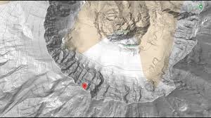
- 3D Terrain Visualization: When users select the “Terrain” view in Google Maps, they can see elevation changes represented in a visually appealing way. This view showcases hills, valleys, and mountains, making it easier to understand the topography of an area.
- Elevation Profiles: Google Maps provides elevation profiles for routes, especially useful for cyclists and hikers. By analyzing the elevation along a given route, users can gauge the steepness and overall difficulty of their journey.
Accessing Elevation Data
Users can access elevation data on Google Maps in several ways:
- Elevation API: Google offers an Elevation API as part of its suite of Google Maps services. This API allows developers to request elevation data for specific locations or along a route programmatically.
- Google Maps App and Website: Users can explore elevation data directly through the Google Maps app or website. By selecting a specific point or drawing a route, users can view the elevation profile and analyze the terrain.
Applications of Google Maps Elevation Data
1. Outdoor Activities
For outdoor enthusiasts, Google Maps elevation data is invaluable. Here are some applications:
- Hiking: Hikers can use elevation profiles to prepare for their adventures, helping them choose trails that match their fitness levels. Steep ascents and descents can be identified in advance, allowing hikers to pack appropriately and plan their pace.
- Cycling: Cyclists can benefit from elevation data to select routes that match their skill level and stamina. Riders can avoid steep climbs or opt for challenging routes based on their preferences.
- Running: Runners can use elevation data to find flat or hilly courses based on their training goals. Many running apps integrate Google Maps elevation data to help users track their performance and plan their routes.
2. Urban Planning
Urban planners rely heavily on elevation data for a variety of reasons:
- Infrastructure Development: Knowing the elevation of land can aid in designing roads, bridges, and buildings. Planners can avoid areas prone to flooding and select sites that will support construction.
- Zoning Regulations: Elevation data can inform zoning decisions, especially in areas where elevation changes significantly affect land use.
- Land Use Management: Planners can analyze how elevation impacts land use and implement strategies to manage development in a way that respects the natural landscape.
3. Environmental Studies
Elevation data plays a crucial role in environmental research:
- Ecosystem Analysis: Different species thrive at different elevations. Understanding elevation data helps researchers analyze biodiversity and study how ecosystems respond to environmental changes.
- Climate Studies: Elevation can significantly impact climate and weather patterns. Researchers can use elevation data to study how temperature and precipitation vary across different altitudes.
- Natural Disasters: Elevation data is essential for predicting and managing natural disasters, such as floods or landslides. Understanding the topography can help in disaster preparedness and response planning.
4. Real Estate
In the real estate sector, elevation data can be a crucial factor:
- Property Valuation: Properties at higher elevations might have better views, leading to higher property values. Elevation data helps buyers and investors assess the potential worth of a property.
- Flood Risk Assessment: Understanding elevation is vital for evaluating flood risk. Properties situated in low-lying areas may face higher insurance premiums or require additional flood mitigation measures.
Limitations of Google Maps Elevation Data
While Google Maps elevation data is incredibly useful, it does have some limitations:
Accuracy
The accuracy of elevation data can vary depending on the source. While Google Maps uses reputable data sources, there may be discrepancies in remote or less populated areas where data is less precise.
Resolution
The resolution of elevation data can also affect its usability. In densely populated urban areas, elevation changes may be more pronounced, while in flatter regions, the resolution may not capture subtle variations in elevation.
Accessibility
While elevation data is widely accessible through Google Maps, it may not always provide the granularity that specialized applications or software offer. Users requiring highly detailed elevation information may need to consult additional resources.
The Future of Google Maps Elevation Data
As technology advances, so too will the capabilities of Google Maps elevation data. Here are some potential future developments:
Improved Data Collection
With the advent of drones and advanced satellite technology, the collection of elevation data will become even more precise. Google may incorporate these newer data sources to enhance the accuracy of its elevation profiles.
Enhanced User Experience
Future updates to Google Maps could include more interactive elevation profiles, allowing users to manipulate data and visualize terrain changes in real-time. Such features could cater to a broader range of outdoor activities and enhance the user experience.
Integration with Augmented Reality (AR)
As augmented reality technology continues to evolve, integrating elevation data into AR experiences could provide users with real-time elevation information while they navigate through various landscapes. This could enhance outdoor activities, such as hiking or cycling, by offering live data about the terrain.
Conclusion
Google Maps elevation data is a powerful tool that can significantly enhance our understanding of the world around us. Whether for outdoor adventures, urban planning, environmental research, or real estate assessments, elevation data plays a vital role in making informed decisions. As technology advances and data collection methods improve, we can expect even more sophisticated and accurate elevation data from Google Maps, further enriching our navigational experiences and contributing to various fields of study.